GTFS in Metro Manila
Metro Manila’s complex network of 1,300 privately-operated passenger transport routes can seem impenetrable for the city's 22.9 million residents and visitors alike. Making sense of it all was a critical precursor to detailed transport appraisal of potential new mass rapid transit routes.
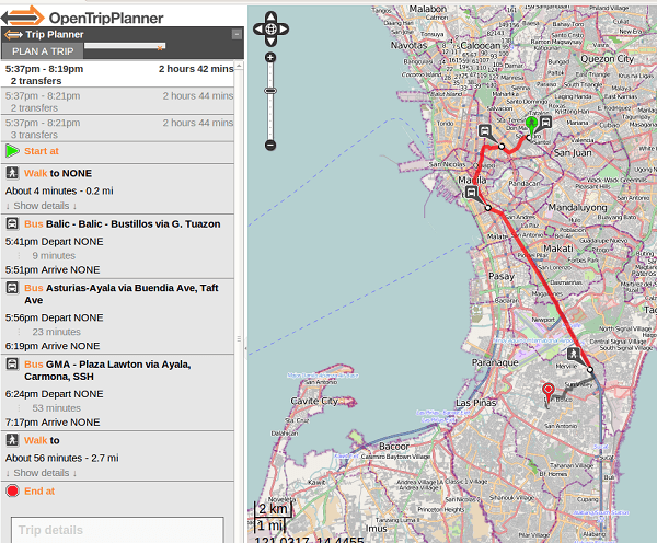
The World Bank commissioned ITP to model Metro Manila’s public transport routes using the General Transit Feed Specification (GTFS) that powers Google’s online journey planning tool. We combined printed franchise data with ground-truth mapping of each bus route and key stopping points using TransitWand – a dedicated survey app developed through the project.
ITP’s work, in partnership with the University of the Philippines, informed Metro Manila’s first ever bus maps. We also built capacity among Government staff for using open source software tools to maintain the GTFS dataset and exploit it in the future. A ‘Hack-a-Thon’ with the local tech community resulted in the city’s first online journey planner, with the underlying data informing supply and demand modelling to make the case for Bus Rapid Transit line investment and major restructuring of the city’s public transport network.